Space and Space Travel News

A place to deposit any information that you feel will be valuable for the members of the forums. This can be published articles, facts or data, or links to interesting places. The adminstrators of this forum take no responsibility for the content of anything posted here, or in any of the other forums.
User avatar
harsi
Posts: 2284
Joined: Sun Jun 05, 2005 1:40 am
Location: Nuremberg, Germany
Contact:

Re: Space and Space Travel News

Post by harsi »

Nasa.gov

Image. (high res.)


Image.NASA’s International Space Station Program Wins Collier Trophy

The International Space Station Program received the 2009 Robert J. Collier Trophy "for the design, development and assembly of the world’s
largest spacecraft, an orbiting laboratory that promises new discoveries for mankind and sets new standards for international cooperation in space."
The National Aeronautic Association (NAA) bestows the award annually to recognize the greatest achievement in aeronautics or astronautics
in America. The Collier Trophy was formally presented at the Annual Collier Dinner on Thursday, May 13, in Arlington, Va. (more)
User avatar
harsi
Posts: 2284
Joined: Sun Jun 05, 2005 1:40 am
Location: Nuremberg, Germany
Contact:

Re: Space and Space Travel News

Post by harsi »

Nasa.gov

NASA Deploys Planes, Targets Satellites to Aid in Oil Spill Response

Image

NASA has mobilized its remote-sensing assets to help assess the spread and impact of the oil spill in the Gulf of Mexico at the request of U.S. disaster response agencies. › Learn More | › View Latest Images | › Latest Images (RSS)


Image.Photos: Complete Oil Spill Coverage
User avatar
harsi
Posts: 2284
Joined: Sun Jun 05, 2005 1:40 am
Location: Nuremberg, Germany
Contact:

Re: Space and Space Travel News

Post by harsi »

Nasa.gov

Atlantis Arrives at Space Station, First Spacewalk Monday


Image

Atlantis arrived at the International Space Station Sunday, delivering the Russian-built Mini Research Module.
Shuttle Section | › Watch Launch Video | ›Watch in HD | › Timeline | › Share Comments | › @NASA_Astronauts→


First Spacewalk for Atlantis Crew Today
Mon, 17 May 2010


Image

- Space shuttle Atlantis is photographed from the International Space Station prior to docking. Image credit: NASA


The crew of space shuttle Atlantis awoke at 3:20 a.m. EDT to the song “Alive Again” by Matt Maher, played for Mission Specialist Mike Good. The crew has been told there will be no focused inspection of the shuttle's heat shield, but they will gather some additional imagery of it on flight day 5. The fourth day of the mission will focus on the first spacewalk, expected to begin at about 8:15 a.m. and last 6.5 hours.


Image.› Complete Shuttle Coverage


Spacewalkers Garrett Reisman and Steve Bowen will install a second station space-to-ground Ku-band antenna and a spare parts platform on Dextre, the two-armed robotic Special Purpose Dexterous Manipulator.The first spacewalk will be the only one not devoted to battery replacement, but Reisman and Bowen will loosen battery bolts on the port-6 backbone segment of the station in preparation for the other spacewalks. Atlantis brought to the station six new 375-pound batteries to be installed during the second and third spacewalks. (more)[/quote]


..HD Videos

Image.Video: Atlantis Launches to the International Space Station

The STS-132 crew will deliver the Russian Mini Research Module, or Rassvet, and perform three spacewalks at the orbital outpost.


Image.Video: Hubble: 20 Years of Discovery

Hubble's discoveries have revolutionized nearly all areas of current astronomical research from planetary science to cosmology. Actor and writer Brent Spiner narrates a visual journey back in time and into the farthest reaches of the cosmos.


Image.Video: Discovery Returns to Kennedy Space Center

The STS-131 returned home on April 20, 2010 after delivering a multi-purpose logistics module filled with science racks to the International Space Station


Image.Video: President Obama Speaks at Kennedy Space Center

US President Obama spoke at the Kennedy Space Center on April 15, 2010 about the new direction for NASA and America's Space Program.
User avatar
harsi
Posts: 2284
Joined: Sun Jun 05, 2005 1:40 am
Location: Nuremberg, Germany
Contact:

Re: Space and Space Travel News

Post by harsi »

Space.gs

Cassini views Saturn's moonlet Aegaeon within its rings.
By Space.gs, 4/15/10


Image.Image credit: NASA/JPL/Space Science Institute


This Cassini spacecraft image holds an unseen treasure orbiting within the bright arc of Saturn’s G ring: the tiny moonlet Aegaeon. The moonlet itself is too small to be seen within the arc pictured here, but is thought to be the source of the debris forming the bright arc in the lower right portion of the G ring in this image. This view looks toward the southern, unilluminated side of the rings from about 4 degrees below the ringplane. Many background stars are visible elongated by the motion of the spacecraft during the image’s exposure.

The image was taken in visible light with the Cassini spacecraft narrow-angle camera on Jan. 24, 2010. The view was obtained at a distance of approximately 1.7 million kilometers (1.1 million miles) from Saturn. Image scale is 10 kilometers (6 miles) per pixel.

The Cassini-Huygens mission is a cooperative project of NASA, the European Space Agency and the Italian Space Agency. The Jet Propulsion Laboratory, a division of the California Institute of Technology in Pasadena, manages the mission for NASA’s Science Mission Directorate, Washington, D.C. The Cassini orbiter and its two onboard cameras were designed, developed and assembled at JPL. The imaging operations center is based at the Space Science Institute in Boulder, Colo.

– courtesy of NASA/JPL/Space Science Institute
User avatar
harsi
Posts: 2284
Joined: Sun Jun 05, 2005 1:40 am
Location: Nuremberg, Germany
Contact:

Re: Space and Space Travel News

Post by harsi »

Image

Space.gs: STS-132, Space Shuttle Atlantis - landing day coverage. > Landing Video

Examiner: Atlantis completes final mission
- CAPE CANAVERAL, FL – After a successful mission the crew of Atlantis landed safely at the Kennedy Space Center’s Shuttle Landing Facility runway 33 at 8:48 a.m. EDT. The landing marked the end of the final scheduled mission
for Atlantis; the orbiter will now be placed on standby as a potential rescue vehicle for the final shuttle mission STS-134. The shuttle program currently has two missions remaining and is scheduled to end this November.

STS-132 carried the Russian Mini-Research Module 1, (MRM-1) also known as the Rassvet (“Dawn”) module and the Integrated Cargo Carrier-Vertical Light Deployable (ICC-VLD) pallet that held a Ku-band Space to Ground Antenna
(SGANT) to the International Space Station. This gives the orbiting outpost a new docking port on the Russian segment of the station, a new Ku-band antenna and a new work platform for the Dextre robot. In short, this mission was
very important in terms of expanding the space station’s capabilities.

Atlantis’ return heralds the end of a historic 25-year career that includes the first flight to a space station, (the Russian station Mir) and the last flight to the Hubble Space Telescope. Eventually Atlantis and the other orbiters will be
sent to museums. Only the shuttle Discovery has been given a specific destination, The Smithsonian Air and Space Museum in Washington D.C.


Image
User avatar
harsi
Posts: 2284
Joined: Sun Jun 05, 2005 1:40 am
Location: Nuremberg, Germany
Contact:

Re: Space and Space Travel News

Post by harsi »

Image.higher res.


Kibo in View

Back dropped by Earth's horizon and the blackness of space, the Japanese Kibo complex of the International Space Station is featured in this image photographed by an Expedition 23 crew member while space shuttle Atlantis remains docked with the station.

Photo credit: NASA Images
User avatar
harsi
Posts: 2284
Joined: Sun Jun 05, 2005 1:40 am
Location: Nuremberg, Germany
Contact:

Re: Space and Space Travel News

Post by harsi »

Image.higher res.

STS-132 and Expedition 23 Crew


STS-132 and Expedition 23 crew members pose for a group portrait on the International Space Station while space shuttle Atlantis remains docked with the station. Pictured on the front row are Russian cosmonaut and Expedition 23 Commander Oleg Kotov (center left); STS-132 Commander Ken Ham; (from the left) NASA astronaut and Expedition 23 Flight Engineer T.J. Creamer, STS-132 Mission Specialist Michael Good; Russian cosmonaut Alexander Skvortsov, Expedition 23 flight engineer; and STS-132 Mission Specialist Garrett Reisman.

Pictured on the back row (from left) are STS-132 Mission Specialist Steve Bowen; Tracy Caldwell Dyson, Expedition 23 flight engineer; STS-132 Mission Specialist Piers Sellers; Russian cosmonaut Mikhail Kornienko, Expedition 23 flight engineer; STS-132 Pilot Tony Antonelli, and Japan Aerospace Exploration Agency astronaut Soichi Noguchi, Expedition 23 flight engineer. - Photo credit: NASA May 23, 2010
User avatar
harsi
Posts: 2284
Joined: Sun Jun 05, 2005 1:40 am
Location: Nuremberg, Germany
Contact:

Re: Space and Space Travel News

Post by harsi »

Image.higher res.

Fond Farewell

Russian cosmonaut and Expedition 23 Commander Oleg Kotov (left) and STS-132 Commander Ken Ham are pictured during a farewell ceremony in the Harmony node of the International Space Station before space shuttle Atlantis undocks from the station. Photo credit: NASA May 23, 2010
User avatar
harsi
Posts: 2284
Joined: Sun Jun 05, 2005 1:40 am
Location: Nuremberg, Germany
Contact:

Re: Space and Space Travel News

Post by harsi »

Image.higher res.


Flight Day 9

Two thirds of the Expedition 23 crew, which is hosting six Atlantis STS-132 astronauts for approximately a week of shared work on the International Space Station, will be joining two crew mates out of frame in saying farewell to the shuttle crew tomorrow, May 23. In the Unity node's foreground are, from left, Japan Aerospace Exploration Agency astronaut Soichi Noguchi, along with NASA astronauts T.J. Creamer and Tracy Caldwell Dyson, all flight engineers. Russian cosmonaut Alexander Skvortsov, Expedition 23 flight engineer, can be seen, partially obscured, in the background. Photo credit: NASA May 22, 2010
User avatar
harsi
Posts: 2284
Joined: Sun Jun 05, 2005 1:40 am
Location: Nuremberg, Germany
Contact:

Re: Space and Space Travel News

Post by harsi »

Image.higher res.


Exercising in 'Tranquility'

NASA astronaut T.J. Creamer, Expedition 23 flight engineer, exercises using the advanced Resistive Exercise Device, or aRED, in the Tranquility node of the International Space Station. Photo credit: NASA May 23, 2010 > NASA Image Gallery


Image

Widespread flooding along the Vistula River in southeastern Poland is featured in this image photographed by an Expedition 23 crew member on the International Space Station. Credit: NASA Space Station Section
User avatar
harsi
Posts: 2284
Joined: Sun Jun 05, 2005 1:40 am
Location: Nuremberg, Germany
Contact:

Re: Space and Space Travel News

Post by harsi »

Image.higher res.


Atlantis is Headed Home

Space shuttle Atlantis and the newly-attached Rassvet Mini-Research Module 1, or MRM-1 are featured in this image photographed by an Expedition 23 crew member on the International Space Station soon after the shuttle and station began their post-undocking relative separation. Undocking of the two spacecraft occurred at 10:22 a.m. CDT on May 23, ending a seven-day stay that saw the addition of a new station module, replacement of batteries and resupply of the orbiting outpost. - Photo credit: NASA May 23, 2010
User avatar
harsi
Posts: 2284
Joined: Sun Jun 05, 2005 1:40 am
Location: Nuremberg, Germany
Contact:

Re: Space and Space Travel News

Post by harsi »

Space.gs

Cassini images Mimas above the ringplane of Saturn.
By Space.gs, 07.01.2010


Image
Image credit: NASA/JPL/Space Science Institute


A kingly crescent Saturn rests on the right of this Cassini spacecraft portrait while the moon Mimas appears above the rings on the left. Mimas looks like just a speck of light here but is actually 396 kilometers,
or 246 miles, across. This view looks toward the northern, sunlit side of the rings from just above the ringplane. Mimas was brightened by a factor of 1.4 relative to Saturn and the rings.

The image was taken with the Cassini spacecraft wide-angle camera on Nov. 28, 2009 using a spectral filter sensitive to wavelengths of near-infrared light centered at 752 nanometers. The view was obtained
at a distance of approximately 2.5 million kilometers (1.6 million miles) from Saturn and at a Sun-Saturn-spacecraft, or phase, angle of 103 degrees. Image scale is 144 kilometers (89 miles) per pixel.

The Cassini-Huygens mission is a cooperative project of NASA, the European Space Agency and the Italian Space Agency. The Jet Propulsion Laboratory, a division of the California Institute of Technology in Pasadena,
manages the mission for NASA's Science Mission Directorate, Washington, D.C. The Cassini orbiter and its two onboard cameras were designed, developed and assembled at JPL. The imaging operations center is
based at the Space Science Institute in Boulder, Colo.

- courtesy of NASA/Jet Propulsion Laboratory
User avatar
harsi
Posts: 2284
Joined: Sun Jun 05, 2005 1:40 am
Location: Nuremberg, Germany
Contact:

Re: Space and Space Travel News

Post by harsi »

Space.gs

GOCE satellite maps Earth's gravity.
European Space Agency, 06/29/10


Image.
Image credit: GOCE High Level Processing Facility


The first global gravity model based on GOCE satellite data has been presented at ESA's Living Planet Symposium. ESA launched GOCE in March 2009 to map Earth's gravity with unprecedented accuracy and resolution. The model, based on only two months of data, from November and December 2009, shows the excellent capability of the satellite to map tiny variations in Earth's gravity.

"GOCE is delivering where it promised: in the fine spatial scales," GOCE Mission Manager Rune Floberghagen said. "We have already been able to identify significant improvements in the high-resolution 'geoid', and the gravity model will improve as more data become available." The geoid is the shape of an imaginary global ocean dictated by gravity in the absence of tides and currents. It is a crucial reference for accurately measuring ocean circulation, sea-level change and ice dynamics - all affected by climate change.

Chairman of the GOCE Mission Advisory Group and Head of the Institute for Astronomical and Physical Geodesy at the Technische Universität München, Prof. Reiner Rummel, said: "The computed global gravity field looks very promising. We can already see that important new information will be obtained for large areas of South America, Africa, Himalaya, South-East Asia and Antarctica."

"Over continents, and in particular in regions poorly mapped with terrestrial or airborne techniques, we can already conclude that GOCE is changing our understanding of the gravity field," Dr Floberghagen added. "Over major parts of the oceans, the situation is even clearer, as the marine gravity field at high spatial resolution is for the first time independently determined by an instrument of such quality."

New GOCE models are already yielding a wealth of new information that is useful for many domains of geosciences. GOCE's final gravity map and geoid will be instrumental in advancing science and applications in a broad range of disciplines, ranging from geodesy, geophysics and surveying to oceanography and sea-level research. "With each two-month cycle of data, the gravity model will become more detailed and accurate. I am convinced that the data will be of great interest to various disciplines of Earth sciences," Prof. Rummel said. In order to achieve its very challenging mission objectives, the satellite was designed to orbit at a very low altitude, where the gravitational variations are stronger closer to Earth.

Since mid-September 2009, GOCE has been in its gravity-mapping orbit at a mere 254.9 km mean altitude - the lowest orbit sustained over a long period by any Earth observation satellite. The residual air at this low altitude causes the orbit of a standard satellite to decay very rapidly. GOCE, however, continuously nullifies the drag in real time by firing an ion thruster using xenon gas. It ensures the gravity sensors are flying as though they are in pure freefall, so they pick up only gravity readings and not the disturbing effects from other forces.

To obtain clean gravity readings, there can be no disturbances from moving parts, so the entire satellite is a single extremely sensitive measuring device. "The gravity measuring system is functioning extremely well. The system is actively compensating for the effects of atmospheric drag and delivering a continuous set of clean gravity readings," Dr Floberghagen said. "This in itself is an excellent technical achievement. GOCE has proven to be a nearly perfect satellite for measuring gravity from space." In May, ESA made available the first set of gravity gradients and 'high-low satellite-to-satellite tracking'. These data are available to scientific and non-commercial users - and much more will come in the following months.

- courtesy of European Space Agency
User avatar
harsi
Posts: 2284
Joined: Sun Jun 05, 2005 1:40 am
Location: Nuremberg, Germany
Contact:

Re: Space and Space Travel News

Post by harsi »

Microsoft and NASA Bring Mars Down to Earth Through the WorldWide Telescope
By Nasa.gov


Image

Microsoft Research and NASA are providing a new experience to users of the WorldWide Telescope. Viewers can now take interactive tours of Mars, hear from NASA scientists, and explore the highest-resolution imagery of the red planet. › Read More


Image.Mars experience at: www.worldwidetelescope.org.
User avatar
harsi
Posts: 2284
Joined: Sun Jun 05, 2005 1:40 am
Location: Nuremberg, Germany
Contact:

Re: Space and Space Travel News

Post by harsi »

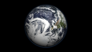
Image.NASA: A Tour of the Cryosphere 2009


The cryosphere consists of those parts of the Earth's surface where water is found in solid form, including areas of snow, sea ice, glaciers, permafrost, ice sheets, and icebergs. In these regions, surface temperatures remain below freezing for a portion of each year. Since ice and snow exist relatively close to their melting point, they frequently change from solid to liquid and back again due to fluctuations in surface temperature. Although direct measurements of the cryosphere can be difficult to obtain due to the remote locations of many of these areas, using satellite observations scientists monitor changes in the global and regional climate by observing how regions of the Earth's cryosphere shrink and expand.

This animation portrays fluctuations in the cryosphere through observations collected from a variety of satellite-based sensors. The animation begins in Antarctica, showing some unique features of the Antarctic landscape found nowhere else on earth. Ice shelves, ice streams, glaciers, and the formation of massive icebergs can be seen clearly in the flyover of the Landsat Image Mosaic of Antarctica. A time series shows the movement of iceberg B15A, an iceberg 295 kilometers in length which broke off of the Ross Ice Shelf in 2000. Moving farther along the coastline, a time series of the Larsen ice shelf shows the collapse of over 3,200 square kilometers ice since January 2002. As we depart from the Antarctic, we see the seasonal change of sea ice and how it nearly doubles the apparent area of the continent during the winter. > read more

Related links >
Post Reply